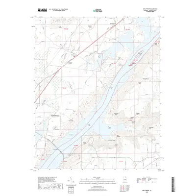
2018 Map of Hollywood
USGS Topo · Published 2018About this map
The Tennessee River forms the central geographic feature of this area, widening into Guntersville Lake and shaping the landscape around Scottsboro and Hollywood. This survey documents a region of intricate river-bottom land and sharp relief, where the water flows past Bellefonte Island and Jones Bar. The high ground is defined by prominent points such as The Pinnacle, Neeley Point, and Webster Point, while gaps like Hale Gap and Hales Ferry Gap reflect historical passage points through the terrain. Numerous family cemeteries are preserved here, including Hansbrough Cem, Finnell Cem, and Sarratt Cem, offering significant data for genealogical research. The presence of Comer Bridge and the John T Reid Pkwy corridor illustrates the modern transportation network that connects these established valley communities.
Find a feature on this map
118 named features on this map. Tap any name to fly to it.
Don’t see what you’re looking for? This feature index may not catch every label — zoom into the map to look around manually.
Map Details
Editions of this 2018 Hollywood Map
This is the sole edition of this map. No revisions or reprints were ever made.
Other maps of this area

1886 · Stevenson
USGS Topo · 1:125,000

1888 · Scottsboro
USGS Topo · 1:125,000

1892 · Scottsboro
USGS Topo · 1:125,000

1892 · Stevenson
USGS Topo · 1:125,000

1895 · Stevenson
USGS Topo · 1:125,000

1936 · Scottsboro
USGS Topo · 1:24,000

1936 · Wannville
USGS Topo · 1:24,000

1936 · Langston
USGS Topo · 1:24,000

1936 · Mud Creek
USGS Topo · 1:24,000

1936 · Dutton
USGS Topo · 1:24,000