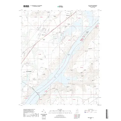
2020 Map of Hollywood
USGS Topo · Published 2020About this map
Guntersville Lake dominates this Jackson County landscape, with its waters surrounding Bellefonte Bar and reaching toward the eastern slopes of Poorhouse Mtn. The terrain is defined by its deep hollows and high points, including Wild Hog Hollow and The Pinnacle, reflecting a complex topography between the valley and Backbone Ridge. This 2020 record of the area near Scottsboro and Hollywood reveals a landscape heavily dotted with family-named burial grounds, such as the Wilhelm Mordah Cem and Byrd Hill Snodgrass Cem, which provide significant data points for genealogical research.
Find a feature on this map
123 named features on this map. Tap any name to fly to it.
Don’t see what you’re looking for? This feature index may not catch every label — zoom into the map to look around manually.
Map Details
Editions of this 2020 Hollywood Map
This is the sole edition of this map. No revisions or reprints were ever made.
Other maps of this area

1886 · Stevenson
USGS Topo · 1:125,000

1888 · Scottsboro
USGS Topo · 1:125,000

1892 · Scottsboro
USGS Topo · 1:125,000

1892 · Stevenson
USGS Topo · 1:125,000

1895 · Stevenson
USGS Topo · 1:125,000

1936 · Scottsboro
USGS Topo · 1:24,000

1936 · Wannville
USGS Topo · 1:24,000

1936 · Langston
USGS Topo · 1:24,000

1936 · Mud Creek
USGS Topo · 1:24,000

1936 · Dutton
USGS Topo · 1:24,000