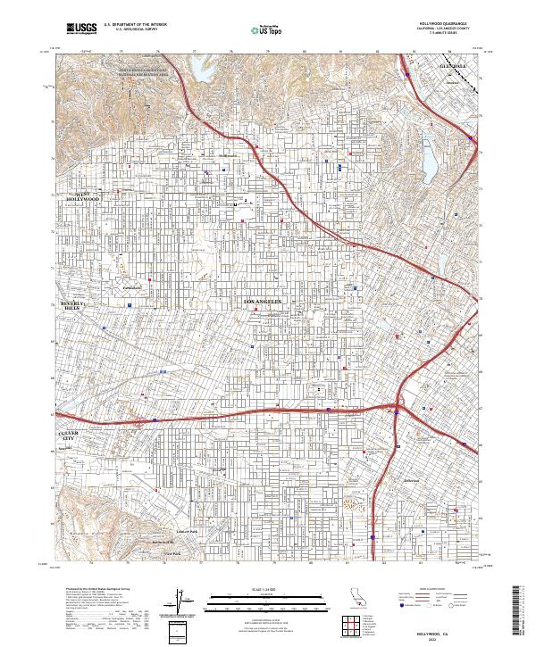
2022 Map of Hollywood
USGS Topo · Published 2022About this map
The Santa Monica Mountains National Recreation Area and the Cahuenga Pass anchor the northern landscape of this detailed Los Angeles survey. The map documents a dense urban fabric of mid-century residential developments and educational institutions, including the sprawling University of Southern California campus and the Los Angeles City College. For those tracing local history, the sheet preserves the locations of iconic creative institutions such as the Musicians Institute and the Los Angeles Film School in Hollywood. The drainage of Ballona Creek and the distinctive footprints of Silver Lake Reservoir and Ivanhoe Reservoir offer a clear look at the managed hydrology of the basin. Established neighborhoods like Parklabrea, Leimert Park, and Baldwin Hills are shown in their contemporary configuration alongside long-standing sites like Beth Olam Cem and Rosedale Cem.
Find a feature on this map
186 named features on this map. Tap any name to fly to it.
Don’t see what you’re looking for? This feature index may not catch every label — zoom into the map to look around manually.
Map Details
Editions of this 2022 Hollywood Map
This is the sole edition of this map. No revisions or reprints were ever made.
Other maps of this area

1894 · Los Angeles
USGS Topo · 1:62,500

1896 · Pasadena
USGS Topo · 1:62,500

1896 · Redondo
USGS Topo · 1:62,500

1896 · Santa Monica
USGS Topo · 1:62,500

1896 · Downey
USGS Topo · 1:62,500

1898 · Santa Monica
USGS Topo · 1:62,500

1899 · Downey
USGS Topo · 1:62,500

1900 · Pasadena
USGS Topo · 1:62,500

1900 · Los Angeles
USGS Topo · 1:62,500

1901 · Southern California Sheet No. 1
USGS Topo · 1:250,000