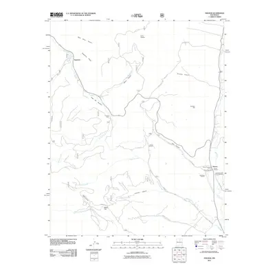
2011 Map of Holman
USGS Topo · Published 2011About this map
Holman serves as the primary center of settlement in this northern New Mexico landscape, situated where the Mora River flows along the eastern edge of the quadrangle. The area is defined by a dense concentration of religious and community burial grounds, including the Holman Presbyterian Cemetery, Agua Negra Cemetery, and the Immaculate Heart of Mary Cemetery, reflecting the deep-seated cultural and family roots of the valley.
Find a feature on this map
39 named features on this map. Tap any name to fly to it.
Don’t see what you’re looking for? This feature index may not catch every label — zoom into the map to look around manually.
Map Details
Editions of this 2011 Holman Map
This is the sole edition of this map. No revisions or reprints were ever made.
Other maps of this area

1889 · Las Vegas
USGS Topo · 1:125,000

1889 · Santa Fe
USGS Topo · 1:125,000

1891 · Las Vegas
USGS Topo · 1:125,000

1893 · Las Vegas
USGS Topo · 1:125,000

1894 · Santa Fe
USGS Topo · 1:125,000

1954 · Santa Fe
USGS Topo · 1:250,000

1954 · Raton
USGS Topo · 1:250,000

1958 · Raton
USGS Topo · 1:250,000

1958 · Santa Fe
USGS Topo · 1:250,000
1963 · Pecos Falls
USGS Topo · 1:24,000