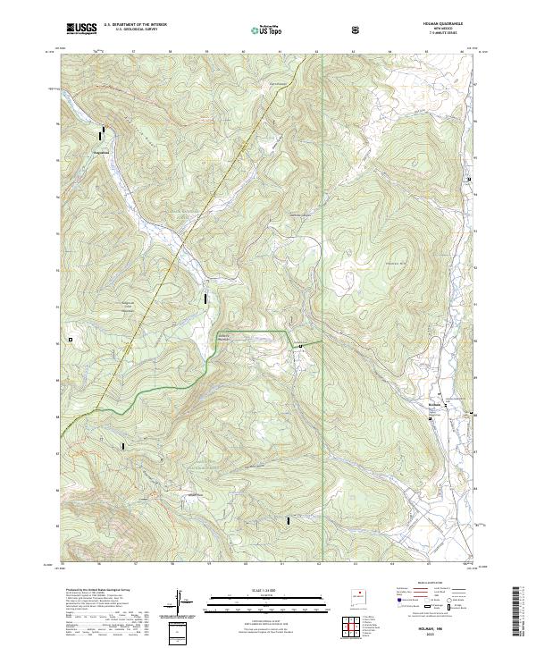
2023 Map of Holman
USGS Topo · Published 2023About this map
The Sangre de Cristo Mountains dominate the western landscape of this Mora County region, where the high-altitude terrain transitions from the Pecos Wilderness into managed forest lands. The settlement of Holman serves as a local hub near the Mora River, situated at the base of Holman Hill. The map reveals a deep-rooted cultural landscape through its numerous burial grounds, including Agua Negra Cem, San Isidro Cem, and the Holman Presbyterian Cem.
Find a feature on this map
61 named features on this map. Tap any name to fly to it.
Don’t see what you’re looking for? This feature index may not catch every label — zoom into the map to look around manually.
Map Details
Editions of this 2023 Holman Map
This is the sole edition of this map. No revisions or reprints were ever made.
Other maps of this area

1889 · Las Vegas
USGS Topo · 1:125,000

1889 · Santa Fe
USGS Topo · 1:125,000

1891 · Las Vegas
USGS Topo · 1:125,000

1893 · Las Vegas
USGS Topo · 1:125,000

1894 · Santa Fe
USGS Topo · 1:125,000

1954 · Santa Fe
USGS Topo · 1:250,000

1954 · Raton
USGS Topo · 1:250,000

1958 · Raton
USGS Topo · 1:250,000

1958 · Santa Fe
USGS Topo · 1:250,000
1963 · Pecos Falls
USGS Topo · 1:24,000