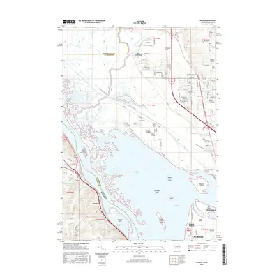
2015 Map of Holmen
USGS Topo · Published 2015About this map
Amsterdam Prairie and the sprawling waters of Lake Onalaska define this riverine landscape along the Mississippi River corridor. The 2015 survey details a complex network of chutes and sloughs, including Dresbach Slough and Goose Chute, that carve through a series of named islands like Cormorant Island and Broken Gun Island. On the eastern bank, the community of Holmen serves as a residential hub, while the smaller settlements of New Amsterdam and Brice Prairie occupy the level terraces above the bottomlands.
Find a feature on this map
141 named features on this map. Tap any name to fly to it.
Don’t see what you’re looking for? This feature index may not catch every label — zoom into the map to look around manually.
Map Details
Editions of this 2015 Holmen Map
This is the sole edition of this map. No revisions or reprints were ever made.
Other maps of this area

1926 · North Bend
USGS Topo · 1:62,500

1927 · La Crosse
USGS Topo · 1:62,500

1929 · Galesville
USGS Topo · 1:62,500

1929 · North Bend
USGS Topo · 1:62,500

1930 · La Crescent
USGS Topo · 1:62,500

1930 · La Crosse
USGS Topo · 1:62,500

1953 · Eau Claire
USGS Topo · 1:250,000

1956 · La Crescent
USGS Topo · 1:62,500

1958 · Eau Claire
USGS Topo · 1:250,000

1958 · La Crosse
USGS Topo · 1:250,000