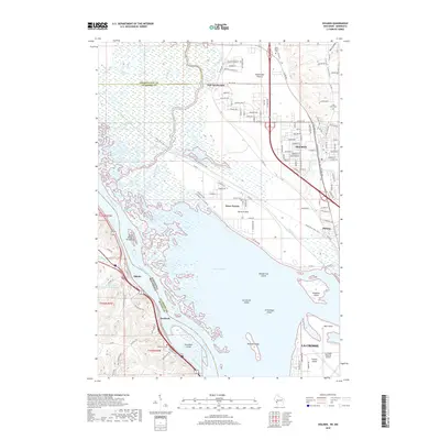
2018 Map of Holmen
USGS Topo · Published 2018About this map
Holmen and the surrounding river flats of the Mississippi Valley define this 2018 survey. The landscape is split between the high bluffs of Amsterdam Prairie and the sprawling, island-dotted waters of Lake Onalaska. This reservoir, created by navigation dams, dominates the central map and contains numerous named features like Broken Gun Island and Cormorant Island. The mapping highlights the intersection of transportation and terrain, showing the La Crosse Regional Airport situated on French Island at the southern edge of the sheet. On the western bank in Minnesota, the village of Dresbach sits beneath the bluffs, while the Wisconsin side shows significant suburban expansion in Midway and the core of Holmen. Local history is preserved in the locations of Green Mound Cem, Long Coulee Cem, and the Dresbach Cem, which anchor the early settlement patterns of these coulee-land communities.
Find a feature on this map
140 named features on this map. Tap any name to fly to it.
Don’t see what you’re looking for? This feature index may not catch every label — zoom into the map to look around manually.
Map Details
Editions of this 2018 Holmen Map
This is the sole edition of this map. No revisions or reprints were ever made.
Other maps of this area

1926 · North Bend
USGS Topo · 1:62,500

1927 · La Crosse
USGS Topo · 1:62,500

1929 · Galesville
USGS Topo · 1:62,500

1929 · North Bend
USGS Topo · 1:62,500

1930 · La Crescent
USGS Topo · 1:62,500

1930 · La Crosse
USGS Topo · 1:62,500

1953 · Eau Claire
USGS Topo · 1:250,000

1956 · La Crescent
USGS Topo · 1:62,500

1958 · Eau Claire
USGS Topo · 1:250,000

1958 · La Crosse
USGS Topo · 1:250,000