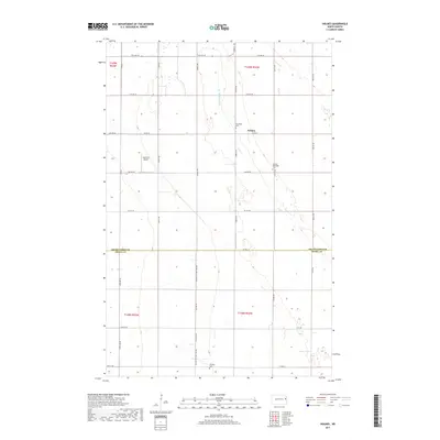
2017 Map of Holmes
USGS Topo · Published 2017About this map
The community of Holmes sits at the intersection of Co Rd 22 and 22nd St NE, serving as a central point in this agricultural landscape of the Red River Valley. The area is defined by its rectilinear section lines and sophisticated water management, most notably seen in the engineered path of Drain Number 28. This 2017 survey highlights several key sites for local genealogy, including the Stjordalen Cem and the Holmes Methodist Cem located just east of the main settlement. Further south, the map documents the Bethany Cem near Co Hwy 14 (151st Ave Ne). The presence of Gensrich Airport on 3rd Ave NE reflects the ongoing importance of private aviation in managing these large agricultural holdings across the Grand Forks and Traill county line.
Find a feature on this map
20 named features on this map. Tap any name to fly to it.
Don’t see what you’re looking for? This feature index may not catch every label — zoom into the map to look around manually.
Map Details
Editions of this 2017 Holmes Map
This is the sole edition of this map. No revisions or reprints were ever made.
Other maps of this area

1934 · Emerado
USGS Topo · 1:48,000

1934 · Grand Forks
USGS Topo · 1:62,500

1936 · Emerado
USGS Topo · 1:62,500

1938 · Grand Forks
USGS Topo · 1:62,500

1952 · Grand Forks
USGS Topo · 1:250,000

1956 · Grand Forks
USGS Topo · 1:250,000

1963 · Emerado SE
USGS Topo · 1:24,000

1963 · Emerado SW
USGS Topo · 1:24,000

1966 · Grand Forks
USGS Topo · 1:250,000
1970 · Hatton
USGS Topo · 1:24,000