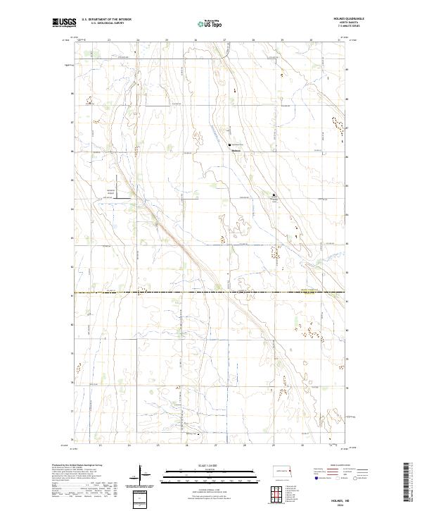
2024 Map of Holmes
USGS Topo · Published 2024About this map
The tiny settlement of Holmes sits at the heart of this agricultural landscape in eastern North Dakota, marking the transition between Grand Forks and Traill counties. This area is characterized by its rigid township and range grid, with roads like County Road 22 and County Highway 25 carving through a terrain of low relief. Genealogists will find significant value in the distribution of community anchors, including Stjordalen Cemetery, Holmes Methodist Cemetery, and Bethany Cemetery, which point to the deep-rooted families that have farmed this land for generations. The drainage system, specifically Drain Number 28, reflects the engineering required to manage the prairie hydrology of the Red River Valley. Aviation history is also present via the Gensrich Airport, a local landing strip that serves as a testament to the importance of aerial utility in the region's modern farming operations.
Find a feature on this map
29 named features on this map. Tap any name to fly to it.
Don’t see what you’re looking for? This feature index may not catch every label — zoom into the map to look around manually.
Map Details
Editions of this 2024 Holmes Map
This is the sole edition of this map. No revisions or reprints were ever made.
Other maps of this area

1934 · Emerado
USGS Topo · 1:48,000

1934 · Grand Forks
USGS Topo · 1:62,500

1936 · Emerado
USGS Topo · 1:62,500

1938 · Grand Forks
USGS Topo · 1:62,500

1952 · Grand Forks
USGS Topo · 1:250,000

1956 · Grand Forks
USGS Topo · 1:250,000

1963 · Emerado SE
USGS Topo · 1:24,000

1963 · Emerado SW
USGS Topo · 1:24,000

1966 · Grand Forks
USGS Topo · 1:250,000
1970 · Hatton
USGS Topo · 1:24,000