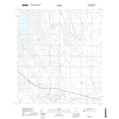
2021 Map of Holopaw
USGS Topo · Published 2021About this map
Holopaw sits at the junction of modern infrastructure and the expansive wetlands of central Florida, where the grid of residential streets like Jupiter Dr and Satellite Ave contrasts with the surrounding marshlands. To the north and east, the landscape is defined by an intricate network of water bodies, including Lake Conlin, Cat Lake, and Major Slough Lake. This 2021 survey reveals a region balancing conservation and rural development, highlighted by the Triple N Ranch Wildlife Management Area Trl. Traces of the area's older transportation network are still visible in the paths of Old Melbourne Hwy and Old Brick Rd, which cut through the drainage basins of Myrtle Slough and Grape Hammock Slough. The presence of the Lake X Airport west of the primary settlement further underscores the area's mix of remote wilderness and specialized landing sites.
Find a feature on this map
51 named features on this map. Tap any name to fly to it.
Don’t see what you’re looking for? This feature index may not catch every label — zoom into the map to look around manually.
Map Details
Editions of this 2021 Holopaw Map
This is the sole edition of this map. No revisions or reprints were ever made.
Other maps of this area

1953 · Holopaw SE
USGS Topo · 1:24,000

1953 · Narcoossee SE
USGS Topo · 1:24,000

1953 · Narcoossee
USGS Topo · 1:24,000

1953 · Deer Park NW
USGS Topo · 1:24,000

1953 · Holopaw SW
USGS Topo · 1:24,000

1953 · Lake Poinsett SW
USGS Topo · 1:24,000

1953 · Deer Park
USGS Topo · 1:24,000

1953 · Ashton
USGS Topo · 1:24,000

1953 · Holopaw
USGS Topo · 1:24,000

1955 · Orlando
USGS Topo · 1:250,000