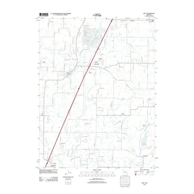
2012 Map of Holt
USGS Topo · Published 2012About this map
Muddy Fork and New Hope Creek carve through the glacial landscape of the Grand River Loess Flats and Drift Hills, defining the rural character of this northern Clay County region. The small communities of Holt, Haynesville, and Converse are linked by a network of local roads and the primary north-south corridor of I-35. The area is notable for its numerous family and community burial grounds, including the Antioch Cemetery, Wilson Cemetery, and Oakland Cemetery, which serve as vital markers of local lineage and early settlement patterns.
Find a feature on this map
110 named features on this map. Tap any name to fly to it.
Don’t see what you’re looking for? This feature index may not catch every label — zoom into the map to look around manually.
Map Details
Editions of this 2012 Holt Map
This is the sole edition of this map. No revisions or reprints were ever made.
Other maps of this area

1894 · Independence
USGS Topo · 1:125,000

1924 · Polo
USGS Topo · 1:62,500

1925 · Plattsburg
USGS Topo · 1:62,500

1936 · Kearney
USGS Topo · 1:48,000

1942 · Kearney
USGS Topo · 1:62,500

1945 · Kearney
USGS Topo · 1:62,500

1950 · Kansas City
USGS Topo · 1:250,000

1954 · Kansas City
USGS Topo · 1:250,000

1956 · Kansas City
USGS Topo · 1:250,000
1957 · Lawson
USGS Topo · 1:24,000