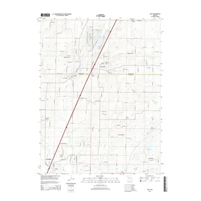
2014 Map of Holt
USGS Topo · Published 2014About this map
Holt and Haynesville straddle the border of Clinton and Clay counties in this early 21st-century survey of western Missouri. The landscape is defined by the winding course of the Muddy Fork and its tributaries, such as New Hope Cr and Carroll Cr, which weave through a mix of agricultural plots and newer residential developments. Local history is deeply embedded in the terrain, evidenced by several resting places including Antioch Cemetery, Converse Cemetery, and Oakland Cemetery. To the south, the northern reaches of Kearney are visible, alongside the local Fairview Cemetery and the Peterson Farm Airport. The map also illustrates modern recreation and infrastructure, from the residential enclave surrounding Lake Arrowhead to the waters of Watkins Mill Lake and the Number 179 Reservoir.
Find a feature on this map
124 named features on this map. Tap any name to fly to it.
Don’t see what you’re looking for? This feature index may not catch every label — zoom into the map to look around manually.
Map Details
Editions of this 2014 Holt Map
This is the sole edition of this map. No revisions or reprints were ever made.
Other maps of this area

1894 · Independence
USGS Topo · 1:125,000

1924 · Polo
USGS Topo · 1:62,500

1925 · Plattsburg
USGS Topo · 1:62,500

1936 · Kearney
USGS Topo · 1:48,000

1942 · Kearney
USGS Topo · 1:62,500

1945 · Kearney
USGS Topo · 1:62,500

1950 · Kansas City
USGS Topo · 1:250,000

1954 · Kansas City
USGS Topo · 1:250,000

1956 · Kansas City
USGS Topo · 1:250,000
1957 · Lawson
USGS Topo · 1:24,000