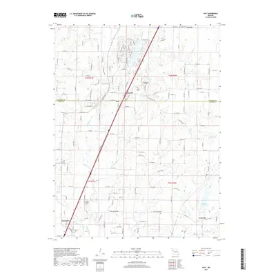
2017 Map of Holt
USGS Topo · Published 2017About this map
Haynesville and Holt anchor this portion of the Clay and Clinton county line, where the landscape transitions from the suburban northern reach of Kearney into a network of agricultural lands and residential developments. The area is defined by its water features, including the sprawling Lake Arrowhead and the extensive Watkins Mill Lake to the southeast. These reservoirs are fed by a complex drainage system led by Muddy Fork, New Hope Cr, and Carroll Cr.
Find a feature on this map
134 named features on this map. Tap any name to fly to it.
Don’t see what you’re looking for? This feature index may not catch every label — zoom into the map to look around manually.
Map Details
Editions of this 2017 Holt Map
This is the sole edition of this map. No revisions or reprints were ever made.
Other maps of this area
1894 · Independence
USGS Topo · 1:125,000
1924 · Polo
USGS Topo · 1:62,500
1925 · Plattsburg
USGS Topo · 1:62,500
1936 · Kearney
USGS Topo · 1:48,000
1942 · Kearney
USGS Topo · 1:62,500
1945 · Kearney
USGS Topo · 1:62,500
1950 · Kansas City
USGS Topo · 1:250,000
1954 · Kansas City
USGS Topo · 1:250,000
1956 · Kansas City
USGS Topo · 1:250,000
1957 · Lawson
USGS Topo · 1:24,000