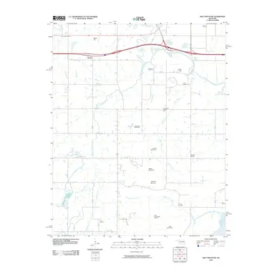
2010 Map of Holt Mountain
USGS Topo · Published 2010About this map
Holt Mountain and a series of prominent peaks rise above the surrounding creek valleys in this Muskogee County landscape near the northern reaches of the Canadian River. This 2010 survey documents a rural environment defined by its hydrology and ancestral landmarks, with Dirty Creek and its many tributaries, including South Fork Dirty Creek and Sulfur Creek, carving through the terrain. The map is particularly valuable for genealogical research, identifying numerous family-named burial grounds such as Popes Chapel Cemetery, Gum Spring Cemetery, and Girty Cemetery that dot the countryside. Human infrastructure is represented by the Muskogee Tpke slicing across the northern section and several water management features like Oknoname 101015 Dam. This modern topographic study preserves the placement of isolated landmarks like Little River Ranch Airport and distinct topographic features such as Winters Hollow and Barker Mountain before further regional development.
Find a feature on this map
26 named features on this map. Tap any name to fly to it.
Don’t see what you’re looking for? This feature index may not catch every label — zoom into the map to look around manually.
Map Details
Editions of this 2010 Holt Mountain Map
This is the sole edition of this map. No revisions or reprints were ever made.
Other maps of this area

1900 · Sansbois
USGS Topo · 1:125,000

1901 · Muscogee
USGS Topo · 1:125,000

1905 · Muscogee
USGS Topo · 1:125,000

1909 · Sans Bois
USGS Topo · 1:125,000

1911 · Sansbois
USGS Topo · 1:125,000

1946 · Fort Smith
USGS Topo · 1:250,000

1948 · Keefeton
USGS Topo · 1:62,500

1948 · Webbers Falls
USGS Topo · 1:62,500

1950 · Keefeton
USGS Topo · 1:62,500

1950 · Webbers Falls
USGS Topo · 1:62,500