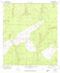
1970 Map of Holt SW
USGS Topo · Published 1972About this map
Eglin Air Force Base dominates this section of Okaloosa County, showcasing the military footprint of the Florida Panhandle during the early 1970s. The landscape is defined by its specialized aviation infrastructure, notably Aux Field No 5 near the settlement of Piccolo and Aux Field No 6 to the northwest. This topography reveals a complex network of drainage systems feeding into the regional watershed, characterized by numerous named water bodies including Metts Creek, Malone Creek, and Middle Creek. Local hydrology is further marked by distinct features like Pocosin Pond and Green Ponds, which suggest the low-lying, often boggy terrain typical of this part of the state. These natural drainage patterns, including Turtle Creek and Live Oak Creek, are meticulously charted alongside military installations, providing a clear view of how defense requirements integrated with the existing physical geography of the Gulf Coast hinterlands.
Find a feature on this map
14 named features on this map. Tap any name to fly to it.
Don’t see what you’re looking for? This feature index may not catch every label — zoom into the map to look around manually.
Map Details
Editions of this 1970 Holt SW Map
2 editions found
Other maps of this area

1921 · Holley
USGS Topo · 1:62,500

1934 · Holt
USGS Topo · 1:48,000

1934 · Harold
USGS Topo · 1:62,500

1936 · Holley
USGS Topo · 1:48,000

1937 · Holt
USGS Topo · 1:62,500

1937 · Harold
USGS Topo · 1:62,500

1938 · Mary Esther
USGS Topo · 1:62,500

1938 · Holley
USGS Topo · 1:62,500

1938 · Harold
USGS Topo · 1:62,500

1956 · Fort Walton Beach
USGS Topo · 1:62,500