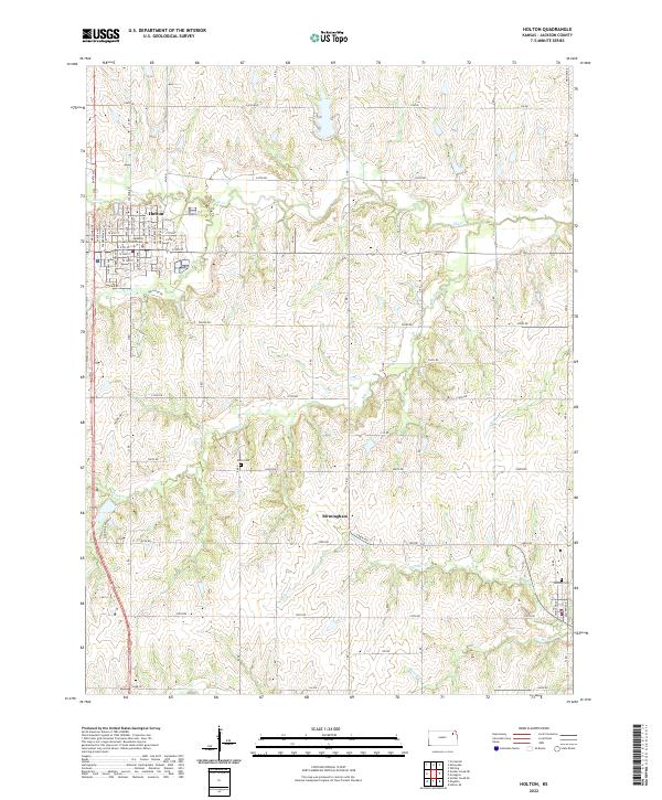
2022 Map of Holton
USGS Topo · Published 2022About this map
Holton serves as the focal point of this Jackson County survey, organized around a traditional grid and the central County Courthouse. This regional hub is defined by its position at the convergence of local routes and the valley of Elk Cr. To the south, the landscape transitions into a more rural character marked by the small settlement of Birmingham. The area is carved by a network of drainage systems, including Banner Cr, Bills Cr, and N Cedar Cr, which dictate the placement of farmsteads and agricultural boundaries. For those researching local heritage, the map identifies specific burial grounds like Brick Cem and Denison Cem, providing clear spatial context for these community landmarks within the township and range system.
Find a feature on this map
46 named features on this map. Tap any name to fly to it.
Don’t see what you’re looking for? This feature index may not catch every label — zoom into the map to look around manually.
Map Details
Editions of this 2022 Holton Map
This is the sole edition of this map. No revisions or reprints were ever made.
Other maps of this area

1888 · Hiawatha
USGS Topo · 1:125,000

1889 · Topeka
USGS Topo · 1:125,000

1894 · Topeka
USGS Topo · 1:125,000

1894 · Hiawatha
USGS Topo · 1:125,000

1950 · Kansas City
USGS Topo · 1:250,000

1954 · Kansas City
USGS Topo · 1:250,000

1956 · Kansas City
USGS Topo · 1:250,000

1960 · Kansas City
USGS Topo · 1:250,000
1960 · Mayetta
USGS Topo · 1:24,000
1960 · Holton
USGS Topo · 1:24,000