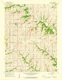
1960 Map of Mayetta
USGS Topo · Published 1961About this map
The Potawatomi Indian Reservation Boundary defines much of the western landscape of this 1960 survey, marking a distinct line through the rolling hills of Jackson County. This division is punctuated by the north-south transit of the Chicago Rock Island and Pacific railroad, which links the settlements of Mayetta and Hoyt. The terrain is deeply incised by the drainage networks of Cedar Creek and Muddy Creek, which have shaped the placement of rural infrastructure.
Find a feature on this map
24 named features on this map. Tap any name to fly to it.
Don’t see what you’re looking for? This feature index may not catch every label — zoom into the map to look around manually.
Map Details
Editions of this 1960 Mayetta Map
2 editions found
Other maps of this area

1889 · Topeka
USGS Topo · 1:125,000

1894 · Topeka
USGS Topo · 1:125,000

1950 · Kansas City
USGS Topo · 1:250,000

1952 · Elmont
USGS Topo · 1:24,000

1952 · Grove
USGS Topo · 1:24,000
1952 · Meriden
USGS Topo · 1:24,000

1954 · Kansas City
USGS Topo · 1:250,000

1956 · Kansas City
USGS Topo · 1:250,000

1960 · Kansas City
USGS Topo · 1:250,000
1960 · Holton
USGS Topo · 1:24,000