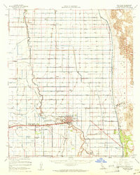
1957 Map of Holtville
USGS Topo · Published 1961About this map
Agricultural development in the Imperial Valley is defined by an intricate network of irrigation, centered on the settlement of Holtville. The Alamo River winds through the landscape, flanked by a rigid grid of canals and laterals such as the East Highline Canal and Pear Canal, which transformed the arid terrain into a productive farming region. Local infrastructure is well-documented, including the Southern Pacific railroad line and various community hubs like Meloland, Alamorio, and Date City.
Find a feature on this map
91 named features on this map. Tap any name to fly to it.
Don’t see what you’re looking for? This feature index may not catch every label — zoom into the map to look around manually.
Map Details
Editions of this 1957 Holtville Map
This is the sole edition of this map. No revisions or reprints were ever made.
Other maps of this area

1907 · Holtville
USGS Topo · 1:125,000

1915 · El Centro
USGS Topo · 1:125,000

1940 · Brawley
USGS Topo · 1:62,500

1940 · Iris
USGS Topo · 1:62,500

1940 · Heber
USGS Topo · 1:62,500

1940 · Alamorio
USGS Topo · 1:62,500

1940 · Calexico
USGS Topo · 1:62,500

1942 · El Centro
USGS Topo · 1:250,000

1943 · Heber
USGS Topo · 1:62,500

1943 · Brawley
USGS Topo · 1:62,500