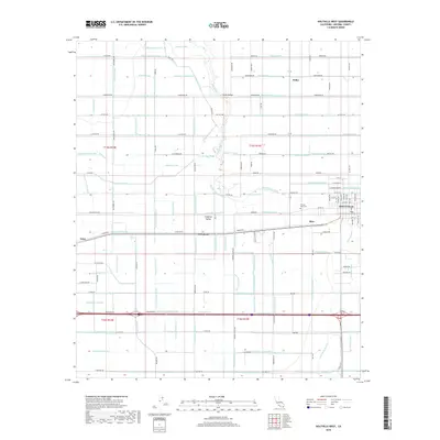
2018 Map of Holtville West
USGS Topo · Published 2018About this map
The Imperial Valley agricultural landscape is defined by an intricate network of irrigation and drainage in this modern survey. The Alamo River snakes through the center of the sheet, crossed by the McKim Bridge as it flows past the small community of Meloland. The city of Holtville sits on the eastern edge of the quadrangle, where the street grid transitions into a vast system of canals including the Rositas Canal and Redwood Canal. These waterways, paired with numbered drains like McCall Drain and Mesquite Drain, reveal the engineering required to sustain desert farming. Local history is anchored by the Terrace Park Cem and several smaller named junctions such as Fuller, Rico, and Anza, which served as critical points in the valley's transport and irrigation corridors.
Find a feature on this map
198 named features on this map. Tap any name to fly to it.
Don’t see what you’re looking for? This feature index may not catch every label — zoom into the map to look around manually.
Map Details
Editions of this 2018 Holtville West Map
This is the sole edition of this map. No revisions or reprints were ever made.
Other maps of this area

1907 · Holtville
USGS Topo · 1:125,000

1915 · El Centro
USGS Topo · 1:125,000

1940 · Brawley
USGS Topo · 1:62,500

1940 · Heber
USGS Topo · 1:62,500

1940 · Alamorio
USGS Topo · 1:62,500

1940 · Calexico
USGS Topo · 1:62,500

1942 · El Centro
USGS Topo · 1:250,000

1943 · Heber
USGS Topo · 1:62,500

1943 · Brawley
USGS Topo · 1:62,500

1943 · Calexico
USGS Topo · 1:62,500