
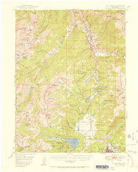
1951 Map of Holy Cross
USGS Topo · Published 1951About this map
Camp Hale and the surrounding White River National Forest dominate this high-altitude landscape shortly after the Second World War. The map details a significant Military Reservation situated along the Denver and Rio Grande Western railroad line, showing the infrastructure of the alpine training facility. To the west, the Sawatch Range rises toward the iconic Mt of the Holy Cross, surrounded by high-basin water bodies like the Bowl of Tears and Lake Constantine.
Find a feature on this map
107 named features on this map. Tap any name to fly to it.
Don’t see what you’re looking for? This feature index may not catch every label — zoom into the map to look around manually.
Map Details
Editions of this 1951 Holy Cross Map
2 editions found
Other maps of this area

1889 · Leadville
USGS Topo · 1:125,000

1891 · Leadville
USGS Topo · 1:125,000

1909 · Mount Jackson
USGS Topo · 1:125,000

1911 · Mount Jackson
USGS Topo · 1:125,000

1929 · Dillon
USGS Topo · 1:62,500

1934 · Climax
USGS Topo · 1:48,000

1934 · Minturn
USGS Topo · 1:62,500

1934 · Dillon
USGS Topo · 1:62,500

1935 · Mount Elbert
USGS Topo · 1:62,500

1938 · Mt. Lincoln
USGS Topo · 1:48,000