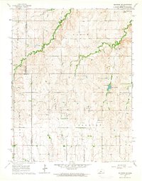
1964 Map of Holyrood NW
USGS Topo · Published 1964About this map
Progress Northwest Oil Field and the Progress Oil Field define the industrial character of this mid-1960s landscape, where oil wells and drill holes are scattered across the central plains. The intersection of Russell, Ellsworth, and Barton counties forms a political boundary that cuts through the drainage basins of Blood Creek and Wolf Creek. In the eastern portion of the map, Holyrood Lake is a prominent water feature near a local Townhall. Evidence of the area's rural social fabric is found in several locations, including the Palacky Cem and a small Cem in the northern section. The map illustrates a transition from the agricultural use of the land to the extraction of resources during this era, with an extensive network of light-duty and unimproved dirt roads connecting these isolated industrial and community sites.
Find a feature on this map
20 named features on this map. Tap any name to fly to it.
Don’t see what you’re looking for? This feature index may not catch every label — zoom into the map to look around manually.
Map Details
Editions of this 1964 Holyrood NW Map
This is the sole edition of this map. No revisions or reprints were ever made.
Other maps of this area

1894 · Ellsworth
USGS Topo · 1:125,000

1896 · Russell
USGS Topo · 1:125,000

1955 · Great Bend
USGS Topo · 1:250,000

1956 · Wilson
USGS Topo · 1:24,000

1956 · Dorrance
USGS Topo · 1:24,000

1957 · Great Bend
USGS Topo · 1:250,000

1957 · Holyrood NE
USGS Topo · 1:24,000

1957 · Black Wolf
USGS Topo · 1:24,000

1958 · Great Bend
USGS Topo · 1:250,000
1964 · Holyrood
USGS Topo · 1:24,000