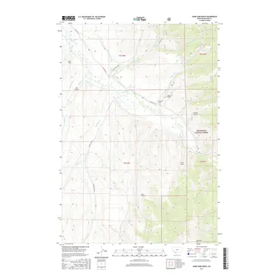
2017 Map of Home Park Ranch
USGS Topo · Published 2017About this map
Home Park Ranch sits at the heart of this Madison County landscape, where the high-elevation terrain is defined by an intricate network of water management and mountain drainage. The map reveals the vital role of irrigation in the region, tracing numerous man-made channels such as the Snapp Donegan Ditch, Peterson Ditch, and Larrabee Ditch as they divert water across the plains. These features highlight the agricultural infrastructure necessary to sustain ranching in the shadow of the Beaverhead National Forest.
Find a feature on this map
38 named features on this map. Tap any name to fly to it.
Don’t see what you’re looking for? This feature index may not catch every label — zoom into the map to look around manually.
Map Details
Editions of this 2017 Home Park Ranch Map
This is the sole edition of this map. No revisions or reprints were ever made.
Other maps of this area

1888 · Three Forks
USGS Topo · 1:250,000

1893 · Dillon
USGS Topo · 1:250,000

1894 · Three Forks
USGS Topo · 1:250,000

1895 · Three Forks
USGS Topo · 1:250,000

1947 · Bozeman
USGS Topo · 1:250,000

1948 · Bozeman
USGS Topo · 1:250,000

1949 · Varney
USGS Topo · 1:62,500

1950 · Monument Ridge
USGS Topo · 1:62,500

1955 · Bozeman
USGS Topo · 1:250,000

1955 · Dubois
USGS Topo · 1:250,000