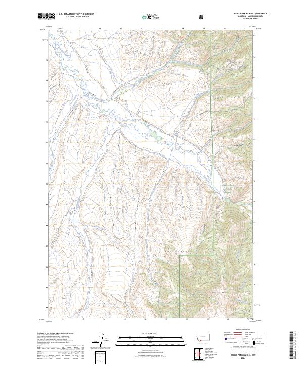
2024 Map of Home Park Ranch
USGS Topo · Published 2024About this map
The Ruby River winds through this Madison County landscape, where an intricate network of historical irrigation infrastructure defines the valley floor. Settlers and ranchers shaped the terrain with extensive water systems, including the Snapp-Donegan Ditch, Peterson Ditch, and Kruse Ditch, many of which follow the natural contours of the land to support agriculture in this high-elevation environment. To the east, the topography rises sharply into the Beaverhead National Forest, culminating in the prominent peaks of the Snowcrest Range and Snowcrest Mtn. These uplands are dissected by numerous drainages such as Clovis Gulch and Powder Gulch. The map reveals a land divided between the managed water resources of the river bottom and the protected wilderness of the mountains, connected by fundamental routes like Upper Ruby Rd and Greenhorn Creek Rd.
Find a feature on this map
39 named features on this map. Tap any name to fly to it.
Don’t see what you’re looking for? This feature index may not catch every label — zoom into the map to look around manually.
Map Details
Editions of this 2024 Home Park Ranch Map
This is the sole edition of this map. No revisions or reprints were ever made.
Other maps of this area

1888 · Three Forks
USGS Topo · 1:250,000

1893 · Dillon
USGS Topo · 1:250,000

1894 · Three Forks
USGS Topo · 1:250,000

1895 · Three Forks
USGS Topo · 1:250,000

1947 · Bozeman
USGS Topo · 1:250,000

1948 · Bozeman
USGS Topo · 1:250,000

1949 · Varney
USGS Topo · 1:62,500

1950 · Monument Ridge
USGS Topo · 1:62,500

1955 · Bozeman
USGS Topo · 1:250,000

1955 · Dubois
USGS Topo · 1:250,000