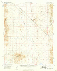
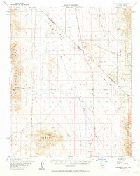
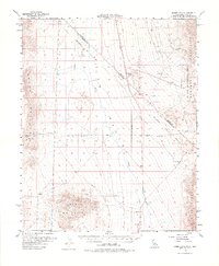
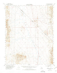
1956 Map of Homer Mtn
USGS Topo · Published 1958About this map
Fort Piute (Ruins) and the nearby Piute Spring anchor the western edge of this desert survey, where historical routes converge through the arid landscape. The Old Government Road serves as a primary artery across the Piute Range, tracing a path near ancient Petroglyphs that speak to much earlier inhabitants. This mid-century documentation also captures the complex surveying history of the region, specifically marking the Von Schmidt Line (1873) which defines the boundary between California and Nevada.
Find a feature on this map
22 named features on this map. Tap any name to fly to it.
Don’t see what you’re looking for? This feature index may not catch every label — zoom into the map to look around manually.
Map Details
Editions of this 1956 Homer Mtn Map
4 editions found
Other maps of this area

1886 · Camp Mohave
USGS Topo · 1:250,000

1892 · Camp Mohave
USGS Topo · 1:250,000

1903 · Needles
USGS Topo · 1:125,000

1904 · Needles Special
USGS Topo · 1:125,000

1910 · Ivanpah
USGS Topo · 1:250,000

1912 · Ivanpah
USGS Topo · 1:250,000

1926 · Mohave City
USGS Topo · 1:96,000

1942 · Camp Mohave
USGS Topo · 1:250,000

1942 · Ivanpah
USGS Topo · 1:250,000

1942 · Amboy
USGS Topo · 1:250,000