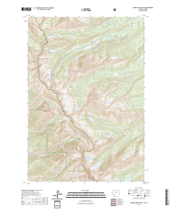
2024 Map of Homer Youngs Peak
USGS Topo · Published 2024About this map
Homer Youngs Peak stands as a central landmark in this high-altitude landscape where the Continental Divide forms the boundary between Beaverhead Co in Montana and Lemhi Co in Idaho. The terrain is defined by a series of prominent summits including Ajax Peak, Copperhead Peak, and Sacajawea Peaks, which together create a dramatic watershed for numerous alpine lake systems. These include the descriptively named Slag-a-melt Lakes and Big Swamp Creek to the north, and Upper Miner Lakes further south.
Find a feature on this map
61 named features on this map. Tap any name to fly to it.
Don’t see what you’re looking for? This feature index may not catch every label — zoom into the map to look around manually.
Map Details
Editions of this 2024 Homer Youngs Peak Map
This is the sole edition of this map. No revisions or reprints were ever made.
Other maps of this area

1950 · Salmon
USGS Topo · 1:62,500

1951 · Salmon
USGS Topo · 1:62,500

1955 · Dillon
USGS Topo · 1:250,000

1956 · Goldstone Mtn
USGS Topo · 1:62,500

1957 · Dillon
USGS Topo · 1:250,000

1958 · Dillon
USGS Topo · 1:250,000

1962 · Dillon
USGS Topo · 1:250,000

1965 · Dillon
USGS Topo · 1:250,000

1966 · Badger Spring Gulch
USGS Topo · 1:24,000

1966 · Shewag Lake
USGS Topo · 1:24,000