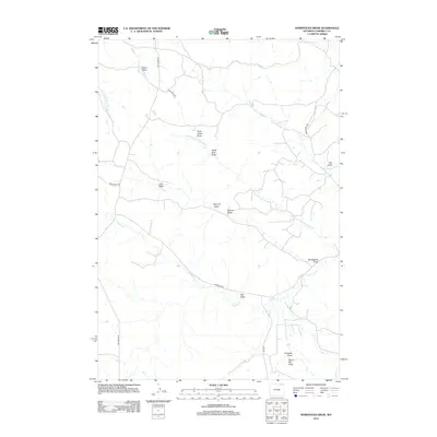
2012 Map of Homestead Draw
USGS Topo · Published 2012About this map
Olmstead Cr and its many seasonal tributaries define this remote corner of Campbell County, where the high plains are carved by a complex network of drainage systems. The landscape is characterized by its numerous named draws, which serve as the primary topographical markers for navigation and land management. Significant landmarks such as Sawmill Draw and Homestead Draw hint at the area's pastoral and utility history, while named routes like Olmstead Rd and Bay Horse Rd provide the essential framework for accessing the isolated ranches of the region.
Find a feature on this map
24 named features on this map. Tap any name to fly to it.
Don’t see what you’re looking for? This feature index may not catch every label — zoom into the map to look around manually.
Map Details
Editions of this 2012 Homestead Draw Map
This is the sole edition of this map. No revisions or reprints were ever made.
Other maps of this area

1954 · Ekalaka
USGS Topo · 1:250,000

1954 · Gillette
USGS Topo · 1:250,000

1955 · Gillette
USGS Topo · 1:250,000

1956 · Ekalaka
USGS Topo · 1:250,000

1958 · Gillette
USGS Topo · 1:250,000

1958 · Ekalaka
USGS Topo · 1:250,000

1962 · Gillette
USGS Topo · 1:250,000

1965 · Ekalaka
USGS Topo · 1:250,000

1970 · Wild Bill Creek
USGS Topo · 1:24,000
1970 · Bay Horse
USGS Topo · 1:24,000