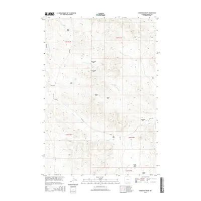
2015 Map of Homestead Draw
USGS Topo · Published 2015About this map
Olmstead Cr and its various forks define the drainage patterns of this high plains landscape in Campbell County. The terrain is deeply incised by a series of geographic features including Homestead Draw, Sawmill Draw, and Plum Creek Draw, which suggest a history of localized land use and seasonal water flow. While largely rural and open, the map records a network of established ranching and access roads such as Olmstead Rd, Bay Horse Rd, and Weischedel Rd. The presence of labels like Coal Gulch points toward the underlying geology of the Powder River Basin. This survey provides a clear view of the Public Land Survey System divisions, marking the boundaries of Townships 56 through 58 North and Ranges 72 through 73 West.
Find a feature on this map
28 named features on this map. Tap any name to fly to it.
Don’t see what you’re looking for? This feature index may not catch every label — zoom into the map to look around manually.
Map Details
Editions of this 2015 Homestead Draw Map
This is the sole edition of this map. No revisions or reprints were ever made.
Other maps of this area

1954 · Ekalaka
USGS Topo · 1:250,000

1954 · Gillette
USGS Topo · 1:250,000

1955 · Gillette
USGS Topo · 1:250,000

1956 · Ekalaka
USGS Topo · 1:250,000

1958 · Gillette
USGS Topo · 1:250,000

1958 · Ekalaka
USGS Topo · 1:250,000

1962 · Gillette
USGS Topo · 1:250,000

1965 · Ekalaka
USGS Topo · 1:250,000

1970 · Wild Bill Creek
USGS Topo · 1:24,000
1970 · Bay Horse
USGS Topo · 1:24,000