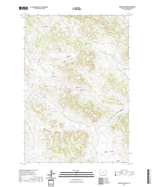
2021 Map of Homestead Draw
USGS Topo · Published 2021About this map
Olmstead Cr and its numerous tributaries define the drainage patterns of this rural landscape in Campbell County. The map reveals an intricate network of named draws that likely served as local landmarks for early ranching families, including Homestead Draw and the family-named Cromack Draw in the southeast. Evidence of early land use and local industry appears in names like Sawmill Draw and Coal Gulch, while transportation is limited to a few arterial routes such as Bay Horse Rd and Olmstead Rd. The terrain is characterized by complex hydrography, featuring the Cookstove Prong Olmstead Cr and the S Fork Olmstead Cr, which together form a dense system of seasonal watercourses across the northern and central sections of the quadrangle.
Find a feature on this map
29 named features on this map. Tap any name to fly to it.
Don’t see what you’re looking for? This feature index may not catch every label — zoom into the map to look around manually.
Map Details
Editions of this 2021 Homestead Draw Map
This is the sole edition of this map. No revisions or reprints were ever made.
Other maps of this area

1954 · Ekalaka
USGS Topo · 1:250,000

1954 · Gillette
USGS Topo · 1:250,000

1955 · Gillette
USGS Topo · 1:250,000

1956 · Ekalaka
USGS Topo · 1:250,000

1958 · Gillette
USGS Topo · 1:250,000

1958 · Ekalaka
USGS Topo · 1:250,000

1962 · Gillette
USGS Topo · 1:250,000

1965 · Ekalaka
USGS Topo · 1:250,000

1970 · Wild Bill Creek
USGS Topo · 1:24,000
1970 · Bay Horse
USGS Topo · 1:24,000