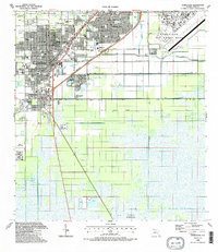
1988 Map of Homestead
USGS Topo · Published 1988About this map
The sprawling grid of Homestead and Florida City meets the intensive canal-and-levee systems of the southern Florida landscape in this late 1980s record. The map documents a period of significant military and institutional presence, anchored by the massive Homestead Air Force Base in the northeast and two separate U S Naval Reservation tracts to the south. The residential expansion of Leisure City and Modello is balanced by the industrial character of the Quarry sites and the Dade Correctional Institution on the southwestern edge.
Find a feature on this map
39 named features on this map. Tap any name to fly to it.
Don’t see what you’re looking for? This feature index may not catch every label — zoom into the map to look around manually.
Map Details
Editions of this 1988 Homestead Map
2 editions found
Other maps of this area

1949 · Card Sound
USGS Topo · 1:24,000

1949 · Arsenicker Keys
USGS Topo · 1:24,000

1949 · Goulds
USGS Topo · 1:24,000

1949 · Perrine
USGS Topo · 1:24,000

1950 · Homestead
USGS Topo · 1:24,000

1950 · Glades
USGS Topo · 1:24,000

1956 · Goulds
USGS Topo · 1:24,000

1956 · Card Sound
USGS Topo · 1:24,000

1956 · Perrine
USGS Topo · 1:24,000

1956 · Grossman Hammock
USGS Topo · 1:24,000