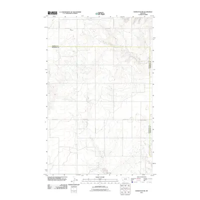
2011 Map of Homestead NW
USGS Topo · Published 2011About this map
Eng Cemetery and Jacobson Cemetery sit as quiet landmarks within this rural northeastern Montana landscape. The terrain is defined by the seasonal drainage of Irish Coulee, which winds through a strictly surveyed grid of section lines and gravel roads. This area reflects the late-twentieth and early-twenty-first-century agricultural character of Roosevelt and Sheridan counties, where family-named thoroughfares like Davis Valley Rd and Flat Center Rd connect isolated farmsteads across the high plains. The transition between West Lake Rd and Homestead Rd illustrates the persistent structure of the Public Land Survey System, which continues to dictate the orientation of regional travel and land use in this sparsely populated region north of the Missouri River.
Find a feature on this map
9 named features on this map. Tap any name to fly to it.
Don’t see what you’re looking for? This feature index may not catch every label — zoom into the map to look around manually.
Map Details
Editions of this 2011 Homestead NW Map
This is the sole edition of this map. No revisions or reprints were ever made.
Other maps of this area

1909 · Smoke Creek
USGS Topo · 1:62,500

1912 · Smoke Creek
USGS Topo · 1:62,500

1914 · Homestead
USGS Topo · 1:62,500

1947 · Rocky Point
USGS Topo · 1:24,000

1947 · Homestead
USGS Topo · 1:24,000

1948 · Homestead
USGS Topo · 1:24,000

1948 · Rocky Point
USGS Topo · 1:24,000

1948 · Alkali Coulee
USGS Topo · 1:24,000

1949 · Alkali Coulee
USGS Topo · 1:24,000

1949 · Johnson Lake
USGS Topo · 1:24,000