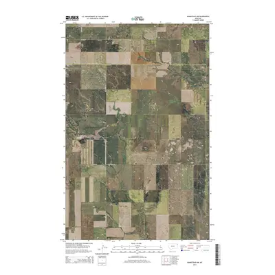
2014 Map of Homestead NW
USGS Topo · Published 2014About this map
The county line between Sheridan County and Roosevelt County cuts directly across this rural expanse of northeastern Montana. The landscape is defined by the drainage patterns of seasonal waterways like Sauerkraut Coulee and Irish Coulee, which shape the topography of the High Plains. This 2014 survey documents the enduring agricultural grid of the region, where a network of gravel routes like Flat Center Rd and W Homestead Rd connect remote farmsteads and sections. For researchers and local historians, the map preserves the locations of two small burial grounds: Eng Cem in the northern portion and Jacobson Cem to the east. These sites, along with the family-named roads such as Davis Valley Rd and Lobo Rd, provide essential reference points for tracing the early 21st-century footprint of these prairie communities.
Find a feature on this map
15 named features on this map. Tap any name to fly to it.
Don’t see what you’re looking for? This feature index may not catch every label — zoom into the map to look around manually.
Map Details
Editions of this 2014 Homestead NW Map
This is the sole edition of this map. No revisions or reprints were ever made.
Other maps of this area

1909 · Smoke Creek
USGS Topo · 1:62,500

1912 · Smoke Creek
USGS Topo · 1:62,500

1914 · Homestead
USGS Topo · 1:62,500

1947 · Rocky Point
USGS Topo · 1:24,000

1947 · Homestead
USGS Topo · 1:24,000

1948 · Homestead
USGS Topo · 1:24,000

1948 · Rocky Point
USGS Topo · 1:24,000

1948 · Alkali Coulee
USGS Topo · 1:24,000

1949 · Alkali Coulee
USGS Topo · 1:24,000

1949 · Johnson Lake
USGS Topo · 1:24,000