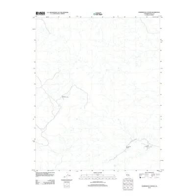
2012 Map of Homewood Canyon
USGS Topo · Published 2012About this map
Homewood Canyon is the central point of interest in this high-desert landscape of Inyo County, where an intricate network of ephemeral watercourses feeds the valley floor. The map documents a sparsely populated but historically frequented region, evidenced by the presence of Bircham Springs Picnic Area and named watering points such as Snooky Spring and Skull Spring. These springs likely served as critical stops for travelers and early inhabitants in a terrain defined by deep incisions like Crow Canyon. Transport through the area is restricted to a few primary arteries, including Homewood Canyon Rd and Crow Canyon Rd, which follow the natural contours of the desert washes. This survey provides a precise account of the drainage patterns and relief that dictate the human footprint in this corner of the California desert.
Find a feature on this map
7 named features on this map. Tap any name to fly to it.
Don’t see what you’re looking for? This feature index may not catch every label — zoom into the map to look around manually.
Map Details
Editions of this 2012 Homewood Canyon Map
This is the sole edition of this map. No revisions or reprints were ever made.
Other maps of this area

1908 · Ballarat
USGS Topo · 1:250,000

1913 · Ballarat
USGS Topo · 1:250,000

1915 · Searles Lake
USGS Topo · 1:250,000

1947 · Trona
USGS Topo · 1:250,000

1948 · Trona
USGS Topo · 1:250,000

1948 · Death Valley
USGS Topo · 1:250,000

1949 · Trona
USGS Topo · 1:62,500

1950 · Trona
USGS Topo · 1:62,500

1951 · Maturango Peak
USGS Topo · 1:62,500

1951 · Coso Peak
USGS Topo · 1:62,500