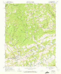
1968 Map of Honaker
USGS Topo · Published 1972About this map
Honaker stands as a focal point in the southwestern corner of this survey, where the Norfolk And Western railroad winds through the valley of Lewis Creek. The landscape of Russell and Buchanan Counties is defined by an intensive network of extractive industry and ridge-top settlements. Countless unnamed Mines and Strip Mines are etched into the hillsides above Wysor Valley and Hess Creek, reflecting the region's heavy reliance on coal mining.
Find a feature on this map
96 named features on this map. Tap any name to fly to it.
Don’t see what you’re looking for? This feature index may not catch every label — zoom into the map to look around manually.
Map Details
Editions of this 1968 Honaker Map
2 editions found
Other maps of this area

1886 · Grundy
USGS Topo · 1:125,000

1890 · Grundy
USGS Topo · 1:125,000

1891 · Tazewell
USGS Topo · 1:125,000

1891 · Abingdon
USGS Topo · 1:125,000

1892 · Grundy
USGS Topo · 1:125,000

1894 · Abingdon
USGS Topo · 1:125,000

1895 · Tazewell
USGS Topo · 1:125,000

1897 · Tazewell
USGS Topo · 1:125,000

1897 · Bristol
USGS Topo · 1:125,000

1902 · Bristol
USGS Topo · 1:125,000