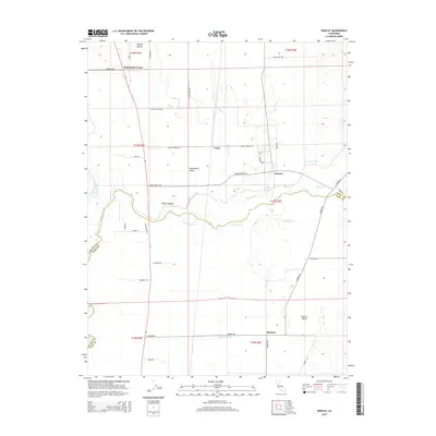
2015 Map of Honcut
USGS Topo · Published 2015About this map
Honcut Creek defines the boundary between Butte and Yuba counties as it flows through the transition between the Sacramento Valley and the Central Valley. In this part of Northern California, the landscape is shaped by the complex drainage systems of the Feather River and its tributaries, including the Wyman Ravine and Wyandotte Cr. Small settlements such as Honcut, Robinsons Corner, and Craig are dispersed across a grid of rural roads, indicating a long-standing agricultural focus. The convergence of N Honcut Cr and S Honcut Cr near the settlement of Honcut highlights the importance of these waterways to the local topography and historical land use. To the south, Simmerly Slough and the settlement of Ramirez reflect the lower-lying, water-rich character of the valley floor.
Find a feature on this map
45 named features on this map. Tap any name to fly to it.
Don’t see what you’re looking for? This feature index may not catch every label — zoom into the map to look around manually.
Map Details
Editions of this 2015 Honcut Map
This is the sole edition of this map. No revisions or reprints were ever made.
Other maps of this area

1888 · Marysville
USGS Topo · 1:125,000

1888 · Smartsville
USGS Topo · 1:125,000

1891 · Marysville
USGS Topo · 1:125,000

1891 · Smartsville
USGS Topo · 1:125,000

1892 · Smartsville
USGS Topo · 1:125,000

1894 · Smartsville
USGS Topo · 1:125,000

1894 · Marysville
USGS Topo · 1:125,000

1895 · Marysville
USGS Topo · 1:125,000

1895 · Smartsville
USGS Topo · 1:125,000

1911 · Sutter
USGS Topo · 1:31,680