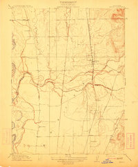
1912 Map of Honcut
USGS Topo · Published 1912About this map
Honcut Creek serves as a defining boundary line between Butte and Yuba counties in this detailed 1912 survey. The landscape reflects a transitional zone between the lowlands of the Feather River and the rising foothills, shaped significantly by the parallel tracks of the Western Pacific and Southern Pacific railroads. These transit corridors supported small rural hubs like Honcut, Ramirez, and Coombs, which functioned as vital connection points for the surrounding agricultural community.
Find a feature on this map
21 named features on this map. Tap any name to fly to it.
Don’t see what you’re looking for? This feature index may not catch every label — zoom into the map to look around manually.
Map Details
Editions of this 1912 Honcut Map
This is the sole edition of this map. No revisions or reprints were ever made.
Other maps of this area

1888 · Marysville
USGS Topo · 1:125,000

1888 · Smartsville
USGS Topo · 1:125,000

1891 · Marysville
USGS Topo · 1:125,000

1891 · Smartsville
USGS Topo · 1:125,000

1892 · Smartsville
USGS Topo · 1:125,000

1894 · Smartsville
USGS Topo · 1:125,000

1894 · Marysville
USGS Topo · 1:125,000

1895 · Marysville
USGS Topo · 1:125,000

1895 · Smartsville
USGS Topo · 1:125,000

1911 · Sutter
USGS Topo · 1:31,680