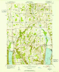
1951 Map of Honeoye
USGS Topo · Published 1952About this map
Honeoye Creek and the southern glacial valleys of Ontario and Livingston Counties define the geography of this 1951 study. The village of Honeoye sits at the foot of Honeoye Lake, serving as a central hub for the surrounding agricultural community. To the west, the settlement of Hemlock marks the northern tip of Hemlock Lake, near the Fairgrounds and Hemlock Lake Park.
Find a feature on this map
64 named features on this map. Tap any name to fly to it.
Don’t see what you’re looking for? This feature index may not catch every label — zoom into the map to look around manually.
Map Details
Editions of this 1951 Honeoye Map
3 editions found
Other maps of this area

1900 · Naples
USGS Topo · 1:62,500

1900 · Canandaigua
USGS Topo · 1:62,500

1901 · Honeoye
USGS Topo · 1:62,500

1902 · Wayland
USGS Topo · 1:62,500

1903 · Naples
USGS Topo · 1:62,500

1903 · Canandaigua
USGS Topo · 1:62,500

1904 · Wayland
USGS Topo · 1:62,500

1904 · Honeoye
USGS Topo · 1:62,500

1913 · Naples
USGS Topo · 1:62,500

1934 · Rush
USGS Topo · 1:24,000