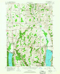
1951 Map of Honeoye
USGS Topo · Published 1967About this map
The glacial valley lakes of Hemlock Lake and Honeoye Lake dominate this 1951 landscape, serving as the north-south anchors for the communities of Hemlock and Honeoye. The region is defined by a series of high ridges and deep hollows, including Frost Hollow and Canadice Hollow, which dictated the early road network and settlement patterns. Local history is deeply etched into the topography through family and community landmarks like Allens Hill, Bosley Corner, and Curtis Corner. Public life in the mid-century is evidenced by the Fairgrounds near Hemlock and the Central School in Honeoye. Genealogists can trace family names through several burial grounds, including Lakeview Cemetery and Short Cemetery. The map also captures small industrial and agricultural details, such as a Gas Well in West Bloomfield and the drainage network of Honeoye Creek and the Canadice Outlet.
Find a feature on this map
71 named features on this map. Tap any name to fly to it.
Don’t see what you’re looking for? This feature index may not catch every label — zoom into the map to look around manually.
Map Details
Editions of this 1951 Honeoye Map
3 editions found
Other maps of this area

1900 · Naples
USGS Topo · 1:62,500

1900 · Canandaigua
USGS Topo · 1:62,500

1901 · Honeoye
USGS Topo · 1:62,500

1902 · Wayland
USGS Topo · 1:62,500

1903 · Naples
USGS Topo · 1:62,500

1903 · Canandaigua
USGS Topo · 1:62,500

1904 · Wayland
USGS Topo · 1:62,500

1904 · Honeoye
USGS Topo · 1:62,500

1913 · Naples
USGS Topo · 1:62,500

1934 · Rush
USGS Topo · 1:24,000