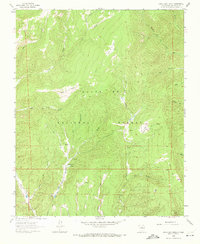
1961 Map of Honey Boy Ranch
USGS Topo · Published 1972About this map
Honey Boy Ranch sits at the heart of this high-elevation landscape in the Santa Fe National Forest, where the terrain is defined by deep canyons and seasonal drainage systems. The 1961 field survey documents a remote ranching and forest environment, characterized by isolated outposts like the Emerson Ranch and the Manzanares Cabin. These sites are linked by a network of primitive transportation routes, specifically designated as Pack Trail and Jeep Trail, which follow the contours of the valley floors and ridges.
Find a feature on this map
29 named features on this map. Tap any name to fly to it.
Don’t see what you’re looking for? This feature index may not catch every label — zoom into the map to look around manually.
Map Details
Editions of this 1961 Honey Boy Ranch Map
3 editions found
Other maps of this area

1889 · Las Vegas
USGS Topo · 1:125,000

1889 · Santa Fe
USGS Topo · 1:125,000

1891 · Las Vegas
USGS Topo · 1:125,000

1893 · Las Vegas
USGS Topo · 1:125,000

1894 · Santa Fe
USGS Topo · 1:125,000

1954 · Santa Fe
USGS Topo · 1:250,000

1958 · Santa Fe
USGS Topo · 1:250,000

1961 · San Geronimo
USGS Topo · 1:24,000

1961 · El Porvenir
USGS Topo · 1:24,000

1961 · Honey Boy Ranch
USGS Topo · 1:24,000