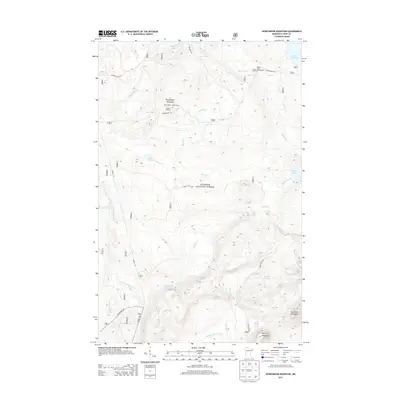
2013 Map of Honeymoon Mountain
USGS Topo · Published 2013About this map
Honeymoon Mountain and the surrounding Sawtooth Mountains dominate this 2013 survey of the Superior National Forest. This section of Cook County, Minnesota, is defined by its complex drainage network, where the Temperance River, Onion River, and Poplar River systems carve through the terrain toward the North Shore. Historical recreation and forestry infrastructure are evident in the presence of the Honeymoon Lookout Tower and the Poplar River Campground, alongside established routes like the Sawbill Trl and Pancore Lake Rd. Local topography is punctuated by numerous water bodies, including the high-elevation Pancake Lake, Frisk Lake, and Barker Lake. The placement of these features reflects the region's long-standing use for both resource management and wilderness access, with named trails like Erickson Trl and Honeymoon Trl weaving between the peaks of Oberg Mountain and the many branches of Sixmile Cr.
Find a feature on this map
29 named features on this map. Tap any name to fly to it.
Don’t see what you’re looking for? This feature index may not catch every label — zoom into the map to look around manually.
Map Details
Editions of this 2013 Honeymoon Mountain Map
This is the sole edition of this map. No revisions or reprints were ever made.
Other maps of this area

1919 · Brule Lake
USGS Topo · 1:62,500

1919 · Lutsen
USGS Topo · 1:62,500

1954 · Two Harbors
USGS Topo · 1:250,000

1955 · Tofte
USGS Topo · 1:24,000

1955 · Schroeder
USGS Topo · 1:24,000

1955 · Tofte
USGS Topo · 1:62,500

1957 · Two Harbors
USGS Topo · 1:250,000

1958 · Two Harbors
USGS Topo · 1:250,000

1959 · Lutsen
USGS Topo · 1:24,000

1960 · Tait Lake
USGS Topo · 1:24,000