
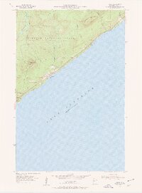
1955 Map of Tofte
USGS Topo · Published 1957About this map
Lake Superior dominates the eastern half of this mid-1950s study, where the North Shore's dramatic rise begins at the water's edge. The settlement of Tofte sits along the shoreline, serving as a gateway to the elevations of the Superior National Forest. Landward, the topography is defined by prominent basaltic features like Carlton Peak and Leveaux Mountain, which stand as landmarks for navigators and hikers alike.
Find a feature on this map
19 named features on this map. Tap any name to fly to it.
Don’t see what you’re looking for? This feature index may not catch every label — zoom into the map to look around manually.
Map Details
Editions of this 1955 Tofte Map
2 editions found
Other maps of this area

1919 · Lutsen
USGS Topo · 1:62,500

1954 · Two Harbors
USGS Topo · 1:250,000

1955 · Schroeder
USGS Topo · 1:24,000

1955 · Tofte
USGS Topo · 1:62,500

1957 · Two Harbors
USGS Topo · 1:250,000

1958 · Two Harbors
USGS Topo · 1:250,000

1959 · Lutsen
USGS Topo · 1:24,000

1964 · Two Harbors
USGS Topo · 1:250,000
1977 · Grand Marais
USGS Topo · 1:100,000
1978 · Outer Island
USGS Topo · 1:100,000