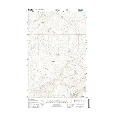
2016 Map of Honeymoon Mountain
USGS Topo · Published 2016About this map
Superior National Forest encompasses this stretch of the North Shore highlands, where the Sawtooth Mountains rise sharply above the Lake Superior basin. The landscape is defined by its complex drainage network, where the Temperance River, Onion River, and Poplar River carve through the high country. Numerous smaller basins such as Barker Lake, Pancake Lake, and Oberg Lake are linked by a dense web of recreational paths. This 2016 survey reveals the extensive development of the Sugarbush trail system, including the Sugarbush Maple Loop and the Sugarbush Oberg Lake Loop. These trails, alongside the long-distance Superior Hiking Trail, illustrate the modern era of the North Shore's transition from early timber extraction to a landscape primarily managed for conservation and backcountry recreation near Honeymoon Mtn.
Find a feature on this map
43 named features on this map. Tap any name to fly to it.
Don’t see what you’re looking for? This feature index may not catch every label — zoom into the map to look around manually.
Map Details
Editions of this 2016 Honeymoon Mountain Map
This is the sole edition of this map. No revisions or reprints were ever made.
Other maps of this area

1919 · Brule Lake
USGS Topo · 1:62,500

1919 · Lutsen
USGS Topo · 1:62,500

1954 · Two Harbors
USGS Topo · 1:250,000

1955 · Tofte
USGS Topo · 1:24,000

1955 · Schroeder
USGS Topo · 1:24,000

1955 · Tofte
USGS Topo · 1:62,500

1957 · Two Harbors
USGS Topo · 1:250,000

1958 · Two Harbors
USGS Topo · 1:250,000

1959 · Lutsen
USGS Topo · 1:24,000

1960 · Tait Lake
USGS Topo · 1:24,000