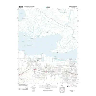
2012 Map of Honker Bay
USGS Topo · Published 2012About this map
Pittsburg and Bay Point anchor the southern shoreline of this survey, where the industrialized Suisun Bay coast transitions into a complex delta landscape. The southern half is defined by residential expansion and infrastructure, featuring the sprawling grounds of Camp Stoneman and the Delta View Golf Course. Water management is central to the area's geography, with the Mokelumne Aqueduct and Contra Costa Canal cutting through the landscape to support the region's growth.
Find a feature on this map
75 named features on this map. Tap any name to fly to it.
Don’t see what you’re looking for? This feature index may not catch every label — zoom into the map to look around manually.
Map Details
Editions of this 2012 Honker Bay Map
This is the sole edition of this map. No revisions or reprints were ever made.
Other maps of this area

1896 · Carquinez Strait
USGS Topo · 1:62,500

1896 · Mt. Diablo
USGS Topo · 1:62,500

1897 · Concord
USGS Topo · 1:62,500

1898 · Karquines
USGS Topo · 1:62,500

1898 · Mt. Diablo
USGS Topo · 1:62,500

1901 · Karquines
USGS Topo · 1:62,500

1902 · Napa
USGS Topo · 1:125,000

1907 · Antioch
USGS Topo · 1:62,500

1908 · Antioch
USGS Topo · 1:62,500

1915 · Concord
USGS Topo · 1:62,500