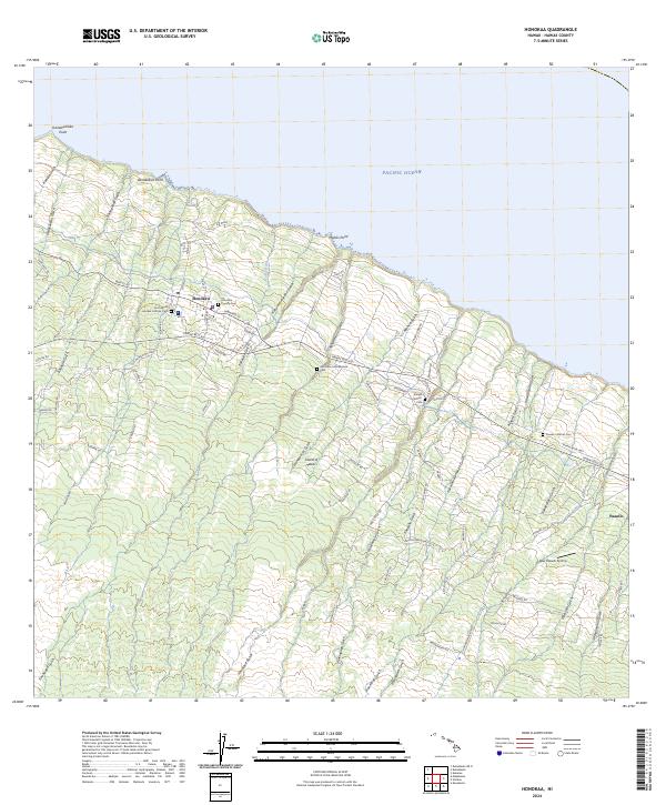
2024 Map of Honokaa
USGS Topo · Published 2024About this map
Honoka'a sits along the northern coastline of the Island of Hawai'i, where the land descends from the interior slopes toward the Pacific Ocean. This modern survey reveals a landscape deeply connected to its agricultural and cultural history, evidenced by the numerous cemeteries and religious missions that dot the terrain between deep gulches. From Our Lady of Lourdes Catholic Cem in the west to the Paauilo Catholic Cem near the settlement of Paauilo, these sites offer significant points of interest for genealogists. The infrastructure reflects the island's economic past, with the Cane Haul Rd and Old Mamalahoa Hwy traversing the coastal hills. The terrain is defined by a dense series of drainages, such as Kukuiaononipahu Gulch and Hanaipoi Iki Gulch, which cut through the volcanic slopes toward coastal points like Mahiki Point.
Find a feature on this map
87 named features on this map. Tap any name to fly to it.
Don’t see what you’re looking for? This feature index may not catch every label — zoom into the map to look around manually.
Map Details
Editions of this 2024 Honokaa Map
This is the sole edition of this map. No revisions or reprints were ever made.
Other maps of this area

1915 · Hamakua
USGS Topo · 1:62,500

1916 · Waipio
USGS Topo · 1:62,500

1954 · Hawaii North
USGS Topo · 1:250,000

1956 · Keanakolu
USGS Topo · 1:24,000

1956 · Makahalau
USGS Topo · 1:24,000

1956 · Umikoa
USGS Topo · 1:24,000

1957 · Kukaiau
USGS Topo · 1:24,000

1957 · Honokaa
USGS Topo · 1:24,000

1959 · Hawaii North
USGS Topo · 1:250,000

1961 · Hawaii North
USGS Topo · 1:250,000