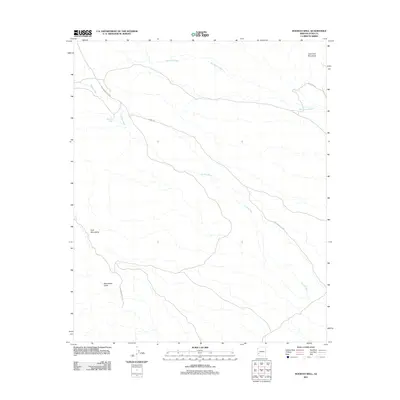
2011 Map of Hoodoo Well
USGS Topo · Published 2011About this map
Hoodoo Well provides a singular point of interest in this arid landscape of the Sonoran Desert, where ephemeral drainage patterns dictate the terrain. The geography is defined by the convergence of several major desert corridors, including Hoodoo Wash and Red Raven Wash, which flow from the high ground of the Kofa Mountains and Little Horn Mountains. The network of desert tracks recorded here, such as Kofa Manganese Rd and Engesser Pass Rd, reveals the historic routes used for prospecting and access to the interior of Yuma County. Near the southern reaches of the quadrangle, Moonshine Gulch cuts through the desert floor, hinting at the remote backcountry character of the region. This 2011 survey illustrates the sparsely populated yet highly articulated drainage systems and access roads that define land use in this part of Arizona.
Find a feature on this map
10 named features on this map. Tap any name to fly to it.
Don’t see what you’re looking for? This feature index may not catch every label — zoom into the map to look around manually.
Map Details
Editions of this 2011 Hoodoo Well Map
This is the sole edition of this map. No revisions or reprints were ever made.
Other maps of this area

1942 · Vicksburg
USGS Topo · 1:250,000

1954 · Phoenix
USGS Topo · 1:250,000

1957 · Phoenix
USGS Topo · 1:250,000

1958 · Phoenix
USGS Topo · 1:250,000

1960 · Phoenix
USGS Topo · 1:250,000

1962 · Little Horn Mts
USGS Topo · 1:62,500

1962 · Kofa Butte
USGS Topo · 1:62,500
1965 · Engesser Pass
USGS Topo · 1:62,500
1965 · Palomas Mts
USGS Topo · 1:62,500

1969 · Phoenix
USGS Topo · 1:250,000