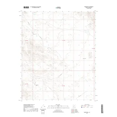
2018 Map of Hoodoo Well
USGS Topo · Published 2018About this map
Hoodoo Well provides a critical focal point in this arid stretch of Yuma County, marking a historic water source in an otherwise dry landscape. The area is defined by its drainage networks and remote transit routes, including the Kofa Manganese Rd and Engesser Pass Rd, which hint at the region's mining and passage history. The topography is characterized by the broad reaches of the Palomas Plain and the carved depressions of Moonshine Gulch.
Find a feature on this map
13 named features on this map. Tap any name to fly to it.
Don’t see what you’re looking for? This feature index may not catch every label — zoom into the map to look around manually.
Map Details
Editions of this 2018 Hoodoo Well Map
This is the sole edition of this map. No revisions or reprints were ever made.
Other maps of this area

1942 · Vicksburg
USGS Topo · 1:250,000

1954 · Phoenix
USGS Topo · 1:250,000

1957 · Phoenix
USGS Topo · 1:250,000

1958 · Phoenix
USGS Topo · 1:250,000

1960 · Phoenix
USGS Topo · 1:250,000

1962 · Little Horn Mts
USGS Topo · 1:62,500

1962 · Kofa Butte
USGS Topo · 1:62,500
1965 · Engesser Pass
USGS Topo · 1:62,500
1965 · Palomas Mts
USGS Topo · 1:62,500

1969 · Phoenix
USGS Topo · 1:250,000