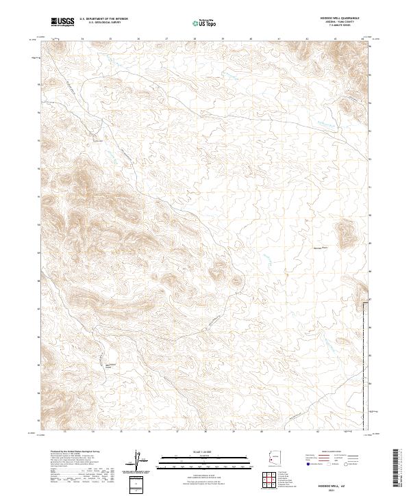
2021 Map of Hoodoo Well
USGS Topo · Published 2021About this map
Hoodoo Well serves as a primary landmark in this arid stretch of Yuma County, marking a vital water source in a landscape defined by seasonal drainage systems. The terrain is etched by the Red Raven Wash to the north and the Hoodoo Wash winding through the central portion of the quadrangle. Transportation through this desert environment relies on a sparse network of specialized routes, including the Kofa Manganese Rd and Engesser Pass Rd, which provide access to this remote region. The map captures the complex topography of the area just before the turn of the decade, illustrating the relationship between the few named water features and the rugged overland tracks like Hoyatter Rd that navigate the desert floor.
Find a feature on this map
11 named features on this map. Tap any name to fly to it.
Don’t see what you’re looking for? This feature index may not catch every label — zoom into the map to look around manually.
Map Details
Editions of this 2021 Hoodoo Well Map
This is the sole edition of this map. No revisions or reprints were ever made.
Other maps of this area

1942 · Vicksburg
USGS Topo · 1:250,000

1954 · Phoenix
USGS Topo · 1:250,000

1957 · Phoenix
USGS Topo · 1:250,000

1958 · Phoenix
USGS Topo · 1:250,000

1960 · Phoenix
USGS Topo · 1:250,000

1962 · Little Horn Mts
USGS Topo · 1:62,500

1962 · Kofa Butte
USGS Topo · 1:62,500
1965 · Engesser Pass
USGS Topo · 1:62,500
1965 · Palomas Mts
USGS Topo · 1:62,500

1969 · Phoenix
USGS Topo · 1:250,000