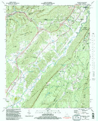
1982 Map of Hooker
USGS Topo · Published 1983About this map
Lookout Mountain dominates the landscape of this 1980s-era survey, where the borders of Georgia, Tennessee, and Alabama converge. The terrain is defined by the massive ridge-and-valley structure of the Appalachians, with Raccoon Mountain and Aetna Mountain rising to the north while Lookout Creek carves a deep path through the center. This region was a critical transportation corridor, shown here through the overlapping tracks of the Louisville and Nashville RR and the Southern Railway.
Find a feature on this map
81 named features on this map. Tap any name to fly to it.
Don’t see what you’re looking for? This feature index may not catch every label — zoom into the map to look around manually.
Map Details
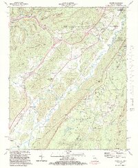
Editions of this 1982 Hooker Map
2 editions found
Other maps of this area

1886 · Ringgold
USGS Topo · 1:125,000

1886 · Stevenson
USGS Topo · 1:125,000

1888 · Chattanooga
USGS Topo · 1:125,000

1892 · Ringgold
USGS Topo · 1:125,000

1892 · Stevenson
USGS Topo · 1:125,000

1893 · Chattanooga
USGS Topo · 1:125,000

1895 · Stevenson
USGS Topo · 1:125,000

1895 · Sewanee
USGS Topo · 1:125,000

1935 · Durham
USGS Topo · 1:24,000

1936 · Trenton
USGS Topo · 1:24,000