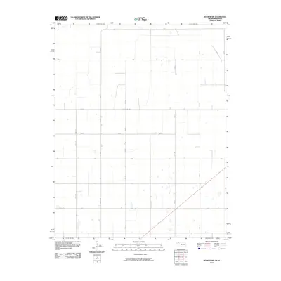
2010 Map of Hooker NW
USGS Topo · Published 2010About this map
Texas County's High Plains terrain dominates this part of the Oklahoma Panhandle, defined by a rigid section-line grid that guides travel across the open agricultural landscape. Primary thoroughfares like Co Hwy D and N 1010 Rd intersect the mile-based system, which includes Mile 45 and Mile 49. The map documents a sparse, functional environment where numerous ephemeral water features and basins are scattered between the surveyed roads. These depressions, often dry, are the primary natural landmarks in an area otherwise characterized by its geometric human organization. The transition from northern Oklahoma into Kansas is marked by the alignment of A Rd at the quadrangle's northern edge, while arterial routes like Road E and Rd G facilitate movement through this remote ranching and farming region.
Find a feature on this map
23 named features on this map. Tap any name to fly to it.
Don’t see what you’re looking for? This feature index may not catch every label — zoom into the map to look around manually.
Map Details
Editions of this 2010 Hooker NW Map
This is the sole edition of this map. No revisions or reprints were ever made.
Other maps of this area

1954 · Perryton
USGS Topo · 1:250,000

1955 · Dodge City
USGS Topo · 1:250,000

1958 · Perryton
USGS Topo · 1:250,000

1958 · Dodge City
USGS Topo · 1:250,000

1959 · Dodge City
USGS Topo · 1:250,000

1967 · Straight NE
USGS Topo · 1:24,000

1967 · Optima
USGS Topo · 1:24,000

1967 · Hooker
USGS Topo · 1:24,000

1967 · Adams
USGS Topo · 1:24,000

1967 · Hooker NW
USGS Topo · 1:24,000