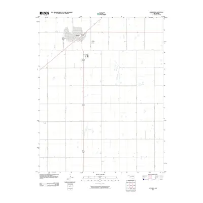
2010 Map of Hooker
USGS Topo · Published 2010About this map
The town of Hooker sits at a critical intersection of the Oklahoma Panhandle, where the high plains landscape is strictly organized by a grid of numbered section roads. This 2010 survey illustrates the town's concentration around its rail-aligned core, extending outward toward the Hooker Municipal Airport and the Hooker Cemetery. Beyond the residential blocks, the terrain is dominated by agricultural development, defined by a network of local routes such as Co Hwy 7, Co Hwy 18, and the specifically named Les White Ind Rd. The map documents the persistent geometry of the Panhandle's rural infrastructure, where water features are sparse and the human footprint is etched into the landscape through miles of straight roads and industrial sites.
Find a feature on this map
24 named features on this map. Tap any name to fly to it.
Don’t see what you’re looking for? This feature index may not catch every label — zoom into the map to look around manually.
Map Details
Editions of this 2010 Hooker Map
This is the sole edition of this map. No revisions or reprints were ever made.
Other maps of this area

1954 · Perryton
USGS Topo · 1:250,000

1958 · Perryton
USGS Topo · 1:250,000

1967 · Straight NE
USGS Topo · 1:24,000

1967 · Optima
USGS Topo · 1:24,000

1967 · Hooker
USGS Topo · 1:24,000

1967 · Adams
USGS Topo · 1:24,000

1967 · Hooker NW
USGS Topo · 1:24,000

1967 · Tyrone
USGS Topo · 1:24,000

1968 · Optima Dam
USGS Topo · 1:24,000

1968 · Hardesty NE
USGS Topo · 1:24,000