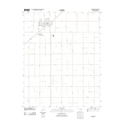
2012 Map of Hooker
USGS Topo · Published 2012About this map
Hooker serves as the central hub of this High Plains landscape in Texas County, structured around a strict grid of section roads and highway corridors. The town's layout is defined by the intersection of Co Hwy-18 and Panhandle St, with residential streets like Jefferson St and Walnut St radiating from the center. A distinctive collection of burial grounds sits just south of the main settlement, including the uniquely named Lutheran Catholic Babyland Cem Cem and the Lutheran Saint Johannes Cem Evangelical Cem, reflecting the area's denominational history. To the northwest, the Hooker Municipal Airport and the landmark noted as Iva Burdge provide additional points of interest. The surrounding landscape is dominated by agricultural development, marked by numerous small depressions and a network of rural routes such as Mile 50 and E0120 Rd.
Find a feature on this map
36 named features on this map. Tap any name to fly to it.
Don’t see what you’re looking for? This feature index may not catch every label — zoom into the map to look around manually.
Map Details
Editions of this 2012 Hooker Map
This is the sole edition of this map. No revisions or reprints were ever made.
Other maps of this area

1954 · Perryton
USGS Topo · 1:250,000

1958 · Perryton
USGS Topo · 1:250,000

1967 · Straight NE
USGS Topo · 1:24,000

1967 · Optima
USGS Topo · 1:24,000

1967 · Hooker
USGS Topo · 1:24,000

1967 · Adams
USGS Topo · 1:24,000

1967 · Hooker NW
USGS Topo · 1:24,000

1967 · Tyrone
USGS Topo · 1:24,000

1968 · Optima Dam
USGS Topo · 1:24,000

1968 · Hardesty NE
USGS Topo · 1:24,000